Hi Everyone:
Today we moved to our present location in southern Oregon near Crater Lake. This post is our third & final day at Yosemite. I will not be able to make the complete post today. We are in another remote location & the Internet is slow but at least we have it this time. I will post as many pictures as possible & complete it tomorrow or the next day.These pictures are from Tuesday May 21st, our third day in Yosemite. This day was a drive along Tioga Road. This road travels from the west entrance of Yosemite across the entire Park and over Tioga Pass. It's a long drive there and back, but the beautiful views along the way and the prize at the end, Mono Lake makes it all so enjoyable. The Park's East exit is at the summit of Tioga Pass. At the pass the road is at an elevation of 9,945 ft. Once through the pass, the landscape entirely changes from the lush green Yosemite Valley and Alpine Regions to a harsh and stark kind of mountain desert region. Tioga Road continues down the mountain to the once mining town of Le Vining and the nearby Mono Lake. While at the ranger station, we were told to be sure to visit Panum Crater. At 650 years old it is the youngest volcano in North America. This was a pleasant & unexpected surprise as you can see by the pictures.
Lou & Barb

Entering Yosemite

One of the Many Roadside Streams & Waterfalls along Tioga Road

Siesta Lake


Barb Wanted to Know What was That Stuff on the Ground That looked Like Snow

Along Tioga Road

Trail to Yosemite Creek

Getting into the Higher Elevations

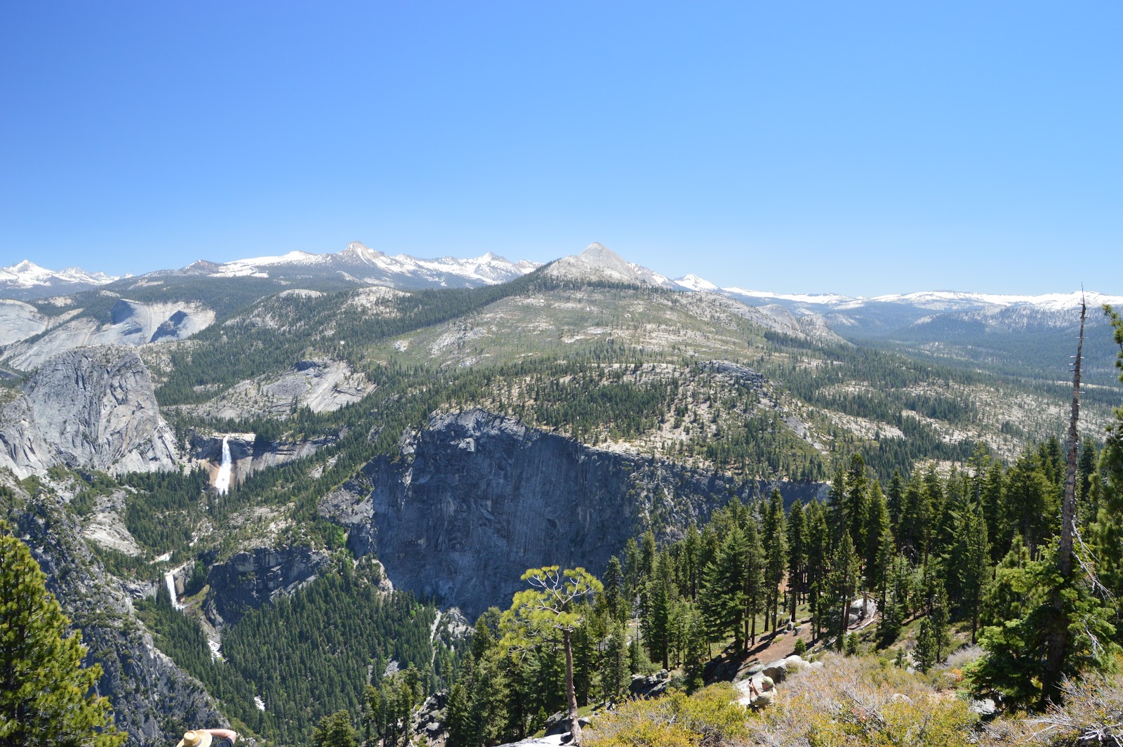
A View To Spectacular For Words

Yosemite Creek, as it Flows Down the Mountain it is Fed by Other Various Streams & Creeks and Cascades into the Valley as Yosemite Falls
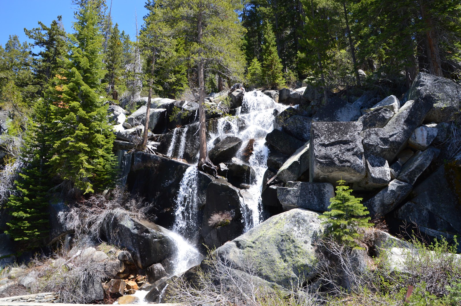
Another Roadside Stream & Waterfall

Tenaya Lake, Elev. 8,500 ft


So Serene & Relaxing, One of Those Places Where you Just Don't Want to Leave


Ellery Lake, We Have Now Crossed over Tioga Pass, Notice How Everything Changes

Ellery Lake Hydro Electric Unit

Tioga Road Facts

Tioga Road Bridge on Edge of Mountain
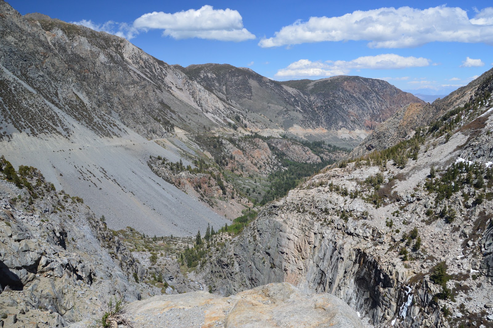
Tioga Road Going Down From Tioga Pass to the Mono Basin


In The Former Mining Town of Le Vining

Mono Lake's Tufa Towers, These unusual spires & knobs are formed when calcium bearing freshwater springs well up through alkaline lake water which is rich in carbonates. The calcium & carbonate combine, precipitating out as limestone. Over many years a tower forms around the mouth of the spring. This Tufa-forming reaction happens only in the lake itself. As the lake level drops & exposes the tufa towers, they cease to grow. Far older tufa towers as old as 13,000 years can still be found high above the current lake, along Mono's ancient shore.

Mono Lake is an ancient sea. Estimated to be more than one million years old, Mono is one of the oldest lakes in North America. Throughout its long existence Eastern Sierra streams have fed Mono Lake with fresh water laden with salts & minerals carried down from the mountains. With no outlet, water can only leave the basin through evaporation, & the salts & minerals are left behind. As a result, Mono Lake is two & a half times as salty & eighty times as alkaline as ocean water. A unique species of half-inch long brine shrimp live in Mono Lake. They have adapted to Mono's special conditions.


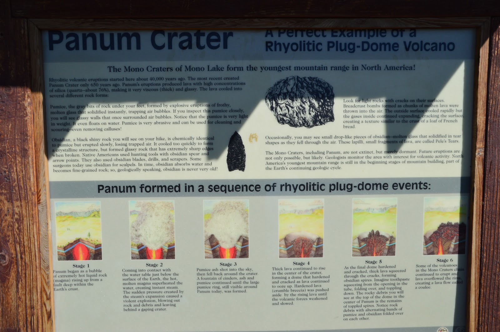
Panum Crater Facts, I Hope Everyone Can Read This it Will Save Me a lot of Typing. Just Google Panum Crater if You Can't

Hiking up the Trail on the Plug Dome

Trail to Top of Plug

On Plug Looking at Crater Rim & Surrounding Area

Exploring Top of Plug Dome


Mono Lake From Top of Plug Dome

Still Exploring Plug Dome


Trail Down From Plug Dome

Delicate Life in a Harsh Environment

Back on Crater Rim Looking at Plug Dome